49km Valle Cupa

Valle Cupa
Ride Overview
Beautiful and wild
49km of beautiful and wild Apennine mountain biking awaits the adventurous rider. The route is a long loop from Scanno to the foot of Mt. Greco, a landmark which dominates the outward journey, and was a talismanic guide to the Allied Prisoners of War who walked across these mountains towards the Allied lines. Highlights, include the second largest lake in the Apennines in which is found the relatively rare Gammarus Lacustris, a small freshwater shrimp which has been stranded here since the last ice age, 8,000 years ago. On the route are flocks of summer grazing sheep, very rudimentary shepherd’s huts, eagles and total solitude.


Ride notes
Scanno’s narrow stone streets, its alpine setting at over 1000m and its women who wear traditional costume, have made it famous well beyond the borders of Abruzzo; it attracts photographers and feature writers from all over the world - it is the poster-boy for this part of Abruzzo. From the carpark above the town, the ride begins as it means to continue - on a wide track which winds up a treelined valley with the mountains of Serra Sparvera and Montagna di Preccia pressing in. The gradient is innocuous to begin with, but soon ramps up steeply up to the appropriately named Passo delle Scalette, the pass of the ladder.

Passo delle Scalette
Once passed the Agriturismo Jovanna, where lunch can be had on weekends in July and August and where there is a fountain to replenish water bottles, the whole character of the ride changes. The white-stoned track branches off to the right towards a road, and the track that you’ll take is grassier and often ill-defined as it heads up to the high meadow pastures.

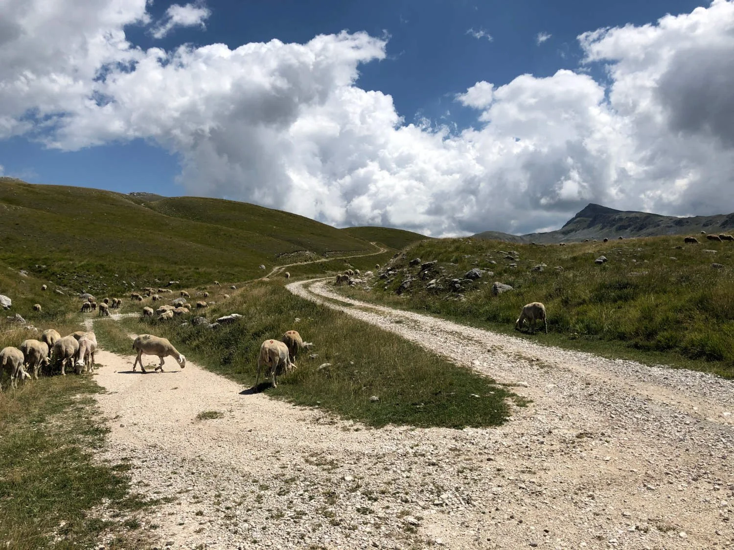
You ride past various abandoned stazzi - the sheep pens into which flocks were herded for the night to protect them against the wolves. The path, for what it is, soon disappears altogether and you ride on grass, which is summer if fragile and crisp. It makes little snapping noises under your wheels. On the right is the big wall of Serra Pantenella, and on the left, Serra Santa Maria. Above you golden eagles fly, and there seem to be many peregrine falcons up here too. The direction is straightforward - keep riding up the valley in a SE direction, with the mountain walls either side and the pyramidal peak of Mt. Greco up ahead.

Serra Pantanella
As the walls of the valley close in, a faint junction of tracks appears around 16km. One branch goes straight on up the valley, the other branches to the left - it is the latter you need. You ride up the hill, and over the ridge, and then on a widening and sure track, you race downhill to the little lake, Lago Pantaniella, said to be the second largest lake in the Apennines. How are such things measured? The area of water is small, but the boggy ground around it, large. It is impossible to access the water for a swim. In the water are some stranded Gammarus Lacustris, freshwater prawn-like creatures, who have been here since the last Ice-Age.

Valle di Chiarano, with Mt. Greco in the distance
The riding for the return leg is very different to that of the outward; the track is clear and wide. It rises and falls, never going higher than 1900m and never lower than 1700m. The route is delightful as you ride through meadows and past stands of beech trees. The landscape has the appearance of an 18th century park, with vistas, trees and grassy meadows, grazed by sheep. All that is missing is the grand house and the lake! You ride past dilapidated shepherd’s huts, often taking the form of abandoned caravans, as well as more stazzi. In summer, there are herds of sheep grazing too, overseen by the shephers (who are invariably watching a film on their phones) and the huge Abruzzi sheepdogs. The latter both look and sound fierce. Approach them slowly, give them as wide a berth as you are able, and they’ll take no interest in you.

Scanno
After the cliffs of Toppe Vurgo have been passed, the route begins to descend, gently at first, then increasingly steeply until you arrive at modern village of Frattura, where you join the only piece of tarmac of the whole ride; a 3km stretch back to the centre of Scanno.
To read the article attached to this ride, click here
Ride Practicalities
At the upper end of the Cupa valley of the outward leg, the track disappears and your ride on grass. In mist or poor weather, ensure you ride in a SE direction until you arrive at a junction of tracks
START/FINISH: Scanno DISTANCE: 50km TOTAL ASCENT: 1482m TERRAIN AND SURFACES: Other than 3km, the route is ridden entirely on tracks which become very faint the further up the valley you ride FOOD AND DRINK: Scanno; La Trattoria Sgabello, Michelin listed, good interpretations of the local dishes, Agriturismo Jovanna, a very part-time restaurant, open mainly at weekends in late July and August. There is a water tap beside the farm wall LINKS TO OTHER RIDES:
Every route on this website has been carefully researched as well as ridden. However situations on the ground can change quickly. If you know of changes to this route, or cafes, pubs and the like which you think other cyclists need to know about, feel free to share your thoughts below.
If you enjoyed this guide, why not subscribe to the website so as not to miss other inspirational routes?
wheremywheelsgo.uk is a Feedspot UK Cycling top website